Big Sycamore Canyon
One Year after the Springs Fire
By Linda O’Hirok, Lecturer, Environmental Science & Resource Management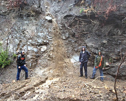
Early on May 2, 2013, the northeast Santa Ana winds were blowing fiercely through the canyons, relative humidity had plummeted to 8%, and chaparral fuel moisture dropped to an unprecedented level. According to the National Weather Service, meteorological conditions were creating the “perfect storm” for a wildfire. A spark ignited chaparral along the Conejo Grade and the Santa Ana winds pushed a rapidly growing fire westward towards CSU Channel Islands, forcing an evacuation of the campus. Three days later the Springs Fire had burned over 24,000 acres all the way to the Pacific Ocean.
Once the smoke had cleared, we recognized the fire presented a unique research and teaching opportunity in our CI “backyard” at Big Sycamore Canyon, in the Santa Monica Mountains. This was a perfect field laboratory for evaluating the effects of chaparral wildfires on the subsequent wet weather sediment transport processes.
In semiarid environments, dense chaparral vegetation stabilizes sediment on steep slopes where it is stored. After wildfire burns the chaparral, the stored sediment is liberated and can slide downhill resting at the margin between the hill-slope and stream channel. There the sediment is poised for removal by rains and winter flows. Post-fire processes are not well understood making prediction difficult.
Joan Florsheim (UCSB), Anne Chin (UC Denver), and I were awarded a National Science Foundation Rapid Response Research Grant to conduct research in Big Sycamore Canyon with four talented CI Environmental Science & Resource Management students: Greg Cutler, Dylan Ellis, Alex Gaskill, and Fletcher Sams.
We observed many dynamic events. For example, ongoing research and monitoring in the canyon documented significant changes in the stream reaches, particularly after three inches of rainfall in February 2014. Cutler developed a model to predict the volume of sediment eroded from the hill-slopes and delivered to the stream channels. Ellis measured the volume for pre- and post-rain events to test the model which yielded results close to the model’s volume predictions. Ellis found that “45 percent of the sediment along the channel banks was transported and deposited in the stream channel.” Gaskill built and installed crest-stage gauges to estimate stream flow and the force required to transport the sediment and debris flows in the channel. Gaskill noted that “the additional sediment throws the stream out of balance and the sediment fills in the steps and pools established for energy dissipation which creates a smoother faster stream bed.”
Sams investigated changes in stream bars and terraces and discovered that “after the rain event, all of the sand bars were buried due to an increase in sediment from the hill-slopes…but the river terraces increased in mass due to debris flows.”
These findings are a continuing validation of the hard work that has been dedicated to this project and will benefit our understanding of these greater frequency fire events.
Return to the Table of Contents© Spring 2014 / Volume 18 / Number 1